

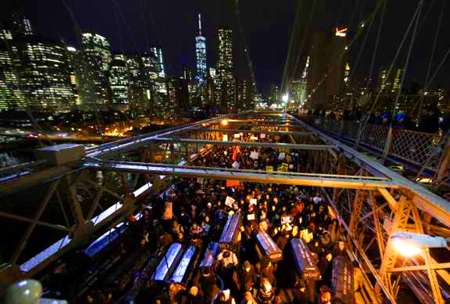
Reading about the protests against police violence in the US, like many others I noted the issue of police militarization, but wondered more about the shift from the occupation of squares that has characterized many recent large-scale protests and the blockading of highways, bridges and ports.
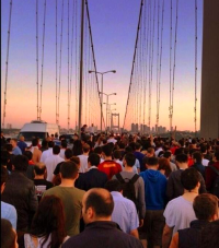 I have no interest in juxtaposing the two, in the sense of arguing that one set of tactics is better than the other, or even less that they are mutually-exclusive. The protests in Turkey gathered around Gezi Park also took to the bridge, for instance.
Still, there are three, related things about the latter that I am curious about. Firstly, they are protests located within the frame of urban infrastructure and not on the idealized model of the city and politics (or the polis) organized around a public square. Secondly, such actions do not concentrate movements into public squares or parks, but generate pauses and stops at critical points of circulation.
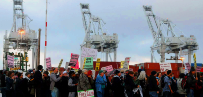
Thirdly, the very act of blockading bridges, ports and highways supplants the circulation of commodities with the movement of people—something that was also in play in the shutting down of Walmart, for example. Clearly one of the greatest things at stake here is who—or what—gets to move around freely and without fear of lethal violence, and indeed how.


Urban theory in the US has reflected something of this, in its shift from the idealized-concentric to the speculative-axial model of cities. In 1923, the US Sociologist Ernest W Burgess put forward a concentric zone theory of urban distribution, growth patterns and forms. What became known as the Chicago School approach to urbanism characterised the spatial form of the city as a unified system organised around a central business district (CBD) and/or some variant of the public square, ringed by zones that radiated outwards.
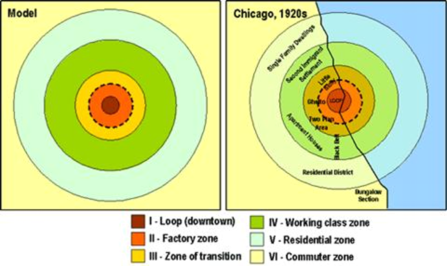
Yet in many respects, Burgess’ sociological theory of city formation was a theory of the spatial ordering of race in the United States. The concentric-zone city was depicted as single entity built on a uniform land surface involving—in the language of Burgess, Park and others—an urban ecology of distinct land use, segregation and radial expansion. Burgess et al‘s typical city is one in which an ostensible historical continuity of a civil and mercantile centre—the park, square and market (or central business district) of a somewhat mythical Antiquarian city and democratic citizenship (citoyen)—is surrounded by the distinctly contemporary urban conflicts around segregation, ‘white flight,’ redlining, gentrification and so on.
Extending and modifying this approach, by the late 1930s Burgess et al’s concentric zone theory was supplemented by the axial model of the Chicago Economist and real estate consultant Homer Hoyt. Hoyt’s city is not so much circular but star-shaped. His amendment to the approach of Burgess et al—that cities expand alongside the routes of transportation routes, bridges and highways—was in some senses an empirical observation. But, in many respects it served as a guide for urban planning and real estate speculation involving not just housing and municipal development but also the profitable siting of large-scale shopping centres and malls. In Hoyt’s urbanism, speculations on race became the key variable of real estate appraisal standards, insurance premia, security maps and underwriting practices.
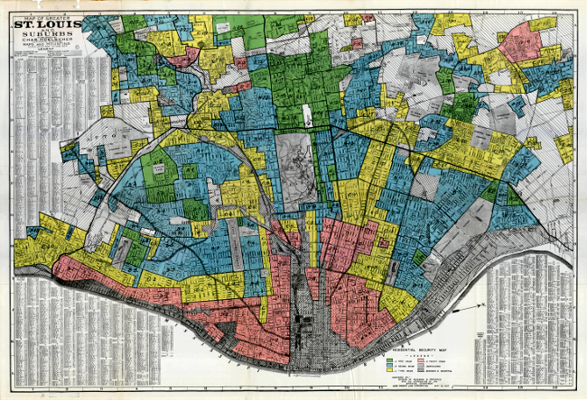
Contemporary zoning, including the formation of enclaves, ‘gated communities’ and privatized ‘public’ spaces might have jumbled the neat star-shaped configuration Hoyt had in mind, but it nevertheless amplifies the importance of urban infrastructure in so doing. Connectivity and circulation remains a premise of zones even as zoning assumes a greater degree of control over permeability and traffic. After all is said and done, the emergence and persistence of a “secessionist automability” and a “splintered urbanism,” among other things, are still predicated on the building and maintenance of highways, roads, bridges and cables.

Reblogged this on synthetic_zero and commented:
Infra-politics is always a corporeal politics and that means not only contesting infrastructure but also the location of bodies “in” time and space- more properly, the contesting of spatiotemporalisation. What I find most interesting in Angela’s discussion is the movement from politics taking place within the idealised image of the Athenian polis to the clogging of the infrastructural pathways that serve as the material portals of interface of the regulation of movement within the society of control. It is no accident that black lives relate in the to the state in a manner homologous with slaves to that polis. If the polis represents an ideal of democratic politics then the blockades of bridges, highways, and streets represents the reminder that the ideal(ism) of democractic politics is bullshit.
Reblogged this on synthetic_zero.
Reblogged this on chez [rebellion] and commented:
really good read.